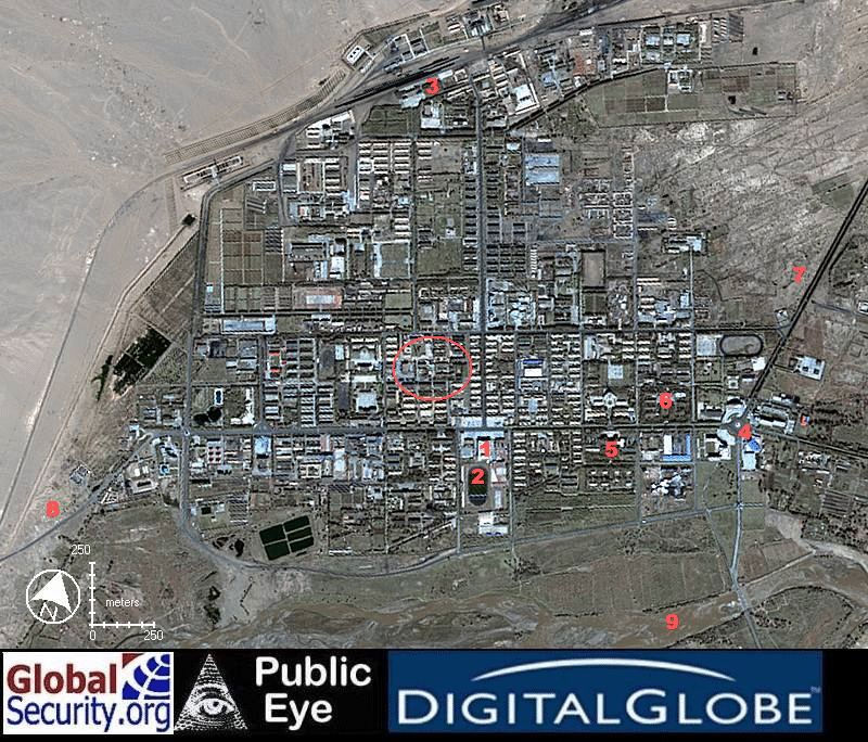
JSLC "town" - an interpretation of the space
image
Sven Grahn
The
satellite image
-
Auditorium and TV station. At
this street corner there was often a policeman directing traffic even though
there were traffic lights. This is where the bank, the post office and
a book-store was located. We also saw a karaoke club near this street corner.
-
Stadium
-
Railway station. This is where
you arrive on the train from the airport 94 km to the south
-
The roundabout with the "egg-like"
sculpture See special
picture page. This is where a lot of new construction seems to have
taken place
-
Range headquarters - it seemed.
-
The hotel where we stayed. It
could be the compound to the west of this, but this is my best guess.
-
The paved, but pot-holed, road
to the old CZ-2C launch pad, about 25 minutes away by car.
-
The dirt road to the water reservoir.
I rode a bicycle out this way a couple of times.
-
This is where I and my colleagues
had a little picnic on 8 october 1992, while waiting for our flight home
after the launch of Freja (1992-64A).
The ellipse shows the general
area where the open-air market was located and where there were two department
stores. I cannot, right now, say exactly where these were, but the general
area is correct.
The image sources are herewith
acknowledged (see caption at the base of the image)
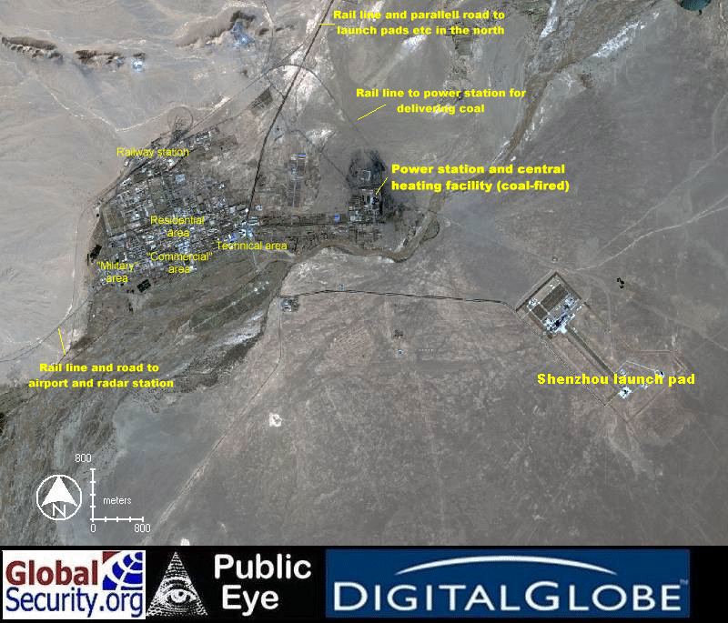
General
view of the area
I have inidcated roughly the
impression I got from my
visit in 1992 what functions were located in various parts of the town.
This is of course a very subjective and inaccuarte view. The location of
the power station I am sure of. One can clearly see the tell-tale signs
of black coal around it.
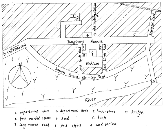
The
little map from 1992
Below is a copy of the little
map provided to myself and colleagues when
visiting JSLC for launching the Freja satellite.

 Back
to Sven's Space Place
Back
to Sven's Space Place